
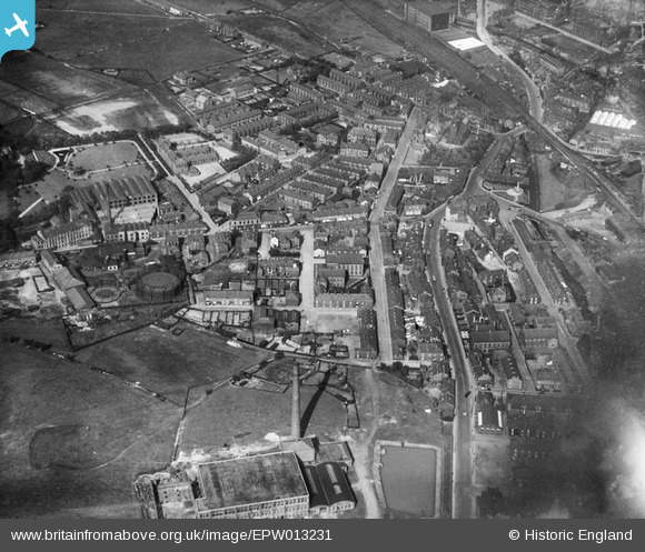
EPW013231 ENGLAND (1925). The town centre, Littleborough, 1925
© Copyright OpenStreetMap contributors and licensed by the OpenStreetMap Foundation. 2024. Cartography is licensed as CC BY-SA.
Nearby Images (5)
EPW013231

EPW016768

EPW016766

EPW016767

EPW013230

Details
| Title | [EPW013231] The town centre, Littleborough, 1925 |
| Reference | EPW013231 |
| Date | June-1925 |
| Link | |
| Place name | LITTLEBOROUGH |
| Parish | |
| District | |
| Country | ENGLAND |
| Easting / Northing | 393620, 416424 |
| Longitude / Latitude | -2.0965188640503, 53.644054248643 |
| National Grid Reference | SD936164 |
Pins
 Izzy |
Tuesday 29th of May 2018 01:56:20 PM | |
Izzy |
Tuesday 29th of May 2018 01:54:36 PM | |
wadey |
Thursday 4th of December 2014 04:10:03 PM | |
wadey |
Thursday 4th of December 2014 04:08:52 PM | |
Spindleshanks |
Tuesday 3rd of July 2012 03:05:55 PM |


