
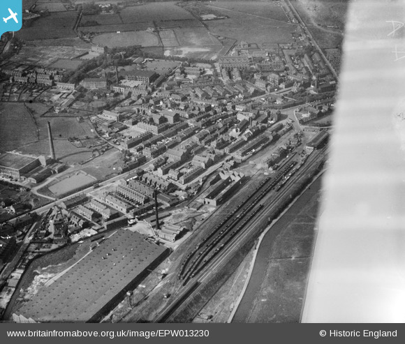
EPW013230 ENGLAND (1925). The town centre, Littleborough, 1925
© Copyright OpenStreetMap contributors and licensed by the OpenStreetMap Foundation. 2024. Cartography is licensed as CC BY-SA.
Nearby Images (7)
EPW013230

EPW016768

EPW032674

EPW013231

EPW016767

EPW016766

EPW032677

Details
| Title | [EPW013230] The town centre, Littleborough, 1925 |
| Reference | EPW013230 |
| Date | June-1925 |
| Link | |
| Place name | LITTLEBOROUGH |
| Parish | |
| District | |
| Country | ENGLAND |
| Easting / Northing | 393594, 416245 |
| Longitude / Latitude | -2.0969085118786, 53.64244485822 |
| National Grid Reference | SD936162 |
Pins
 Pete1nlancs |
Wednesday 26th of October 2016 09:39:24 PM |


