
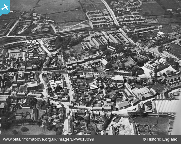
EPW013099 ENGLAND (1925). The town centre, Clitheroe, 1925. This image has been produced from a copy-negative.
© Copyright OpenStreetMap contributors and licensed by the OpenStreetMap Foundation. 2024. Cartography is licensed as CC BY-SA.
Nearby Images (5)
EPW013099

EPW038844

EPW058408

EPW058412

EPW058409

Details
| Title | [EPW013099] The town centre, Clitheroe, 1925. This image has been produced from a copy-negative. |
| Reference | EPW013099 |
| Date | June-1925 |
| Link | |
| Place name | CLITHEROE |
| Parish | CLITHEROE |
| District | |
| Country | ENGLAND |
| Easting / Northing | 374458, 441978 |
| Longitude / Latitude | -2.3885179691201, 53.873171138994 |
| National Grid Reference | SD745420 |


