
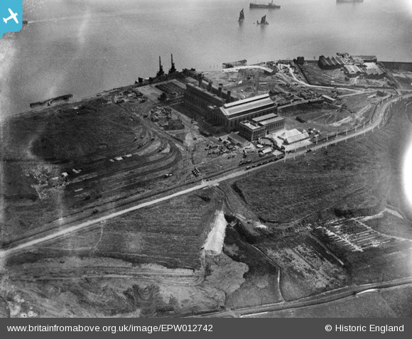
EPW012742 ENGLAND (1925). Barking Power Station, Creekmouth, 1925
© Copyright OpenStreetMap contributors and licensed by the OpenStreetMap Foundation. 2024. Cartography is licensed as CC BY-SA.
Nearby Images (19)
EPW012742

EPW012740

EAW001441

EPW012743

EPW036789

EPW012739

EPW010666

EPW009692

EPW009691

EPW010662

EPW009688

EPW009685

EPW009687

EPW009686

EPW009689

EPW032828

EPW010661

EPW009690

EPW010667

Details
| Title | [EPW012742] Barking Power Station, Creekmouth, 1925 |
| Reference | EPW012742 |
| Date | April-1925 |
| Link | |
| Place name | CREEKMOUTH |
| Parish | |
| District | |
| Country | ENGLAND |
| Easting / Northing | 546616, 181959 |
| Longitude / Latitude | 0.11333230457796, 51.517017727416 |
| National Grid Reference | TQ466820 |
Pins
Be the first to add a comment to this image!


