
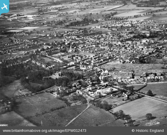
EPW012473 ENGLAND (1925). Upton and environs, Slough, 1925. This image has been produced from a copy-negative.
© Copyright OpenStreetMap contributors and licensed by the OpenStreetMap Foundation. 2024. Cartography is licensed as CC BY-SA.
Details
| Title | [EPW012473] Upton and environs, Slough, 1925. This image has been produced from a copy-negative. |
| Reference | EPW012473 |
| Date | April-1925 |
| Link | |
| Place name | SLOUGH |
| Parish | |
| District | |
| Country | ENGLAND |
| Easting / Northing | 497866, 179338 |
| Longitude / Latitude | -0.58979492941419, 51.504008830329 |
| National Grid Reference | SU979793 |
Pins
 Mike Holder |
Friday 2nd of February 2018 08:42:26 PM | |
Mike Holder |
Friday 2nd of February 2018 08:41:00 PM | |
Mike Holder |
Friday 2nd of February 2018 08:38:37 PM | |
Mike Holder |
Friday 2nd of February 2018 08:37:37 PM | |
Mike Holder |
Friday 2nd of February 2018 08:36:50 PM | |
Mike Holder |
Friday 2nd of February 2018 08:35:30 PM | |
dave43 |
Friday 2nd of January 2015 08:55:40 PM | |
dave43 |
Friday 2nd of January 2015 08:55:05 PM | |
dave43 |
Friday 2nd of January 2015 08:54:13 PM | |
dave43 |
Friday 2nd of January 2015 08:53:41 PM |


