
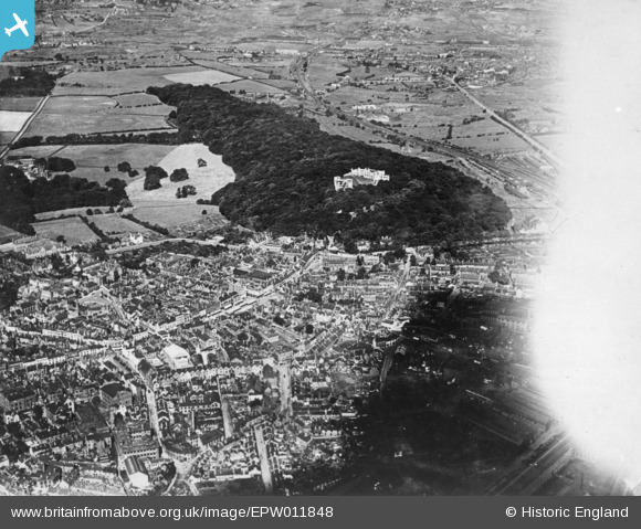
EPW011848 ENGLAND (1924). The castle and environs, Dudley, 1924. This image has been produced from a copy-negative affected by flare.
© Copyright OpenStreetMap contributors and licensed by the OpenStreetMap Foundation. 2024. Cartography is licensed as CC BY-SA.
Nearby Images (21)
EPW011848

EPW053074

EAW007502

EAW045886

EAW001193

EAW007506

EAW001195

EAW007501

EPW022573

EAW045887

EAW049883

EAW007504

EAW001194

EAW007507

EAW007503

EAW007505

EAW045888

EAW045890

EAW045891

EAW049880

EAW045889

Details
| Title | [EPW011848] The castle and environs, Dudley, 1924. This image has been produced from a copy-negative affected by flare. |
| Reference | EPW011848 |
| Date | September-1924 |
| Link | |
| Place name | DUDLEY |
| Parish | |
| District | |
| Country | ENGLAND |
| Easting / Northing | 394630, 290523 |
| Longitude / Latitude | -2.0791361490117, 52.512204130817 |
| National Grid Reference | SO946905 |
Pins
 Paul |
Monday 30th of March 2020 11:02:21 PM | |
 black country history hunter |
Thursday 10th of September 2015 11:00:21 PM | |
black country history hunter |
Thursday 10th of September 2015 10:55:18 PM | |
black country history hunter |
Thursday 10th of September 2015 10:54:10 PM |


