
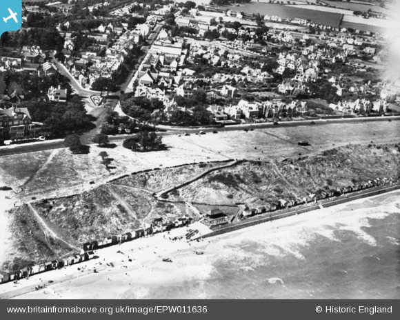
EPW011636 ENGLAND (1924). The Greensward, Frinton-On-Sea, 1924. This image has been produced from a print.
© Copyright OpenStreetMap contributors and licensed by the OpenStreetMap Foundation. 2024. Cartography is licensed as CC BY-SA.
Nearby Images (7)
EPW011636

EPW041407

EAW025896

EAW054838

EPW018529

EPW041406

EAW025897

Details
| Title | [EPW011636] The Greensward, Frinton-On-Sea, 1924. This image has been produced from a print. |
| Reference | EPW011636 |
| Date | 21-August-1924 |
| Link | |
| Place name | FRINTON-ON-SEA |
| Parish | FRINTON AND WALTON |
| District | |
| Country | ENGLAND |
| Easting / Northing | 623832, 219484 |
| Longitude / Latitude | 1.2487872486344, 51.82860593866 |
| National Grid Reference | TM238195 |
Pins
Be the first to add a comment to this image!


