
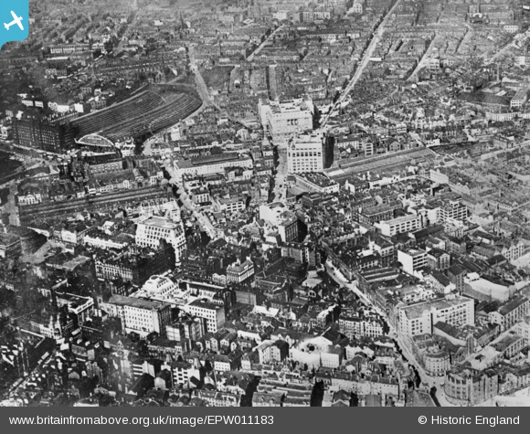
EPW011183 ENGLAND (1924). Ranelagh Street and the city, Liverpool, 1924. This image has been produced from a copy-negative.
© Copyright OpenStreetMap contributors and licensed by the OpenStreetMap Foundation. 2024. Cartography is licensed as CC BY-SA.
Nearby Images (9)
EPW011183

EPR000326

EPW055687

EPW011169

EAW001913

EPW055685

EPW006525

EPW055688

EPW026160

Details
| Title | [EPW011183] Ranelagh Street and the city, Liverpool, 1924. This image has been produced from a copy-negative. |
| Reference | EPW011183 |
| Date | July-1924 |
| Link | |
| Place name | LIVERPOOL |
| Parish | |
| District | |
| Country | ENGLAND |
| Easting / Northing | 334858, 390230 |
| Longitude / Latitude | -2.9799624612591, 53.404603370986 |
| National Grid Reference | SJ349902 |
Pins
 Sparhawk42 |
Thursday 16th of July 2020 01:51:20 AM | |
Sparhawk42 |
Thursday 16th of July 2020 01:50:39 AM |


