
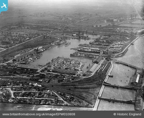
EPW010808 ENGLAND (1924). Alexandra Dock, Kingston upon Hull, from the south-west, 1924
© Copyright OpenStreetMap contributors and licensed by the OpenStreetMap Foundation. 2024. Cartography is licensed as CC BY-SA.
Nearby Images (11)
EPW010808

EPW036527

EPW036392

EPW036554

EAW324975

EAW004506

EAW004505

EPW010818

EPW036386

EPW036427

EPW010812

Details
| Title | [EPW010808] Alexandra Dock, Kingston upon Hull, from the south-west, 1924 |
| Reference | EPW010808 |
| Date | June-1924 |
| Link | |
| Place name | KINGSTON UPON HULL |
| Parish | |
| District | |
| Country | ENGLAND |
| Easting / Northing | 512043, 428776 |
| Longitude / Latitude | -0.30091739073938, 53.743083773908 |
| National Grid Reference | TA120288 |
Pins
 John Wass |
Sunday 14th of September 2014 07:51:41 PM |
User Comment Contributions
.JPG) Alexandra Dock undergoing a lot of changes. The old buildings have made way for the Renewable Energy Business. |
D Prideaux |
Wednesday 15th of April 2015 04:53:43 PM |


