
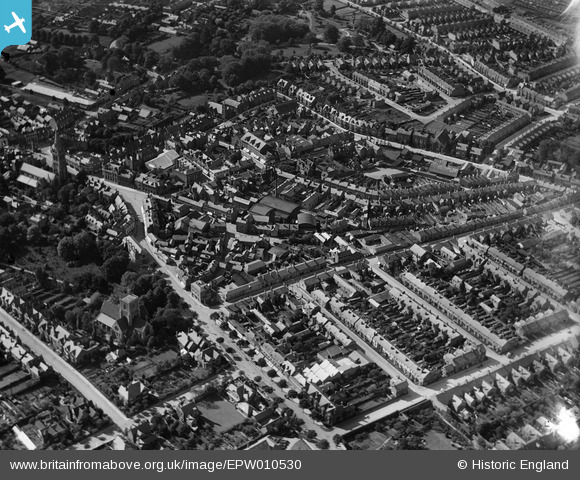
EPW010530 ENGLAND (1924). Castle Street and environs, Rugby, 1924
© Copyright OpenStreetMap contributors and licensed by the OpenStreetMap Foundation. 2024. Cartography is licensed as CC BY-SA.
Nearby Images (5)
EPW010530

EPW012039

EPW033936

EPW033935

EPW021014

Details
| Title | [EPW010530] Castle Street and environs, Rugby, 1924 |
| Reference | EPW010530 |
| Date | 28-May-1924 |
| Link | |
| Place name | RUGBY |
| Parish | |
| District | |
| Country | ENGLAND |
| Easting / Northing | 450585, 275289 |
| Longitude / Latitude | -1.2568852866392, 52.372924709719 |
| National Grid Reference | SP506753 |
Pins
 NCTaylor |
Tuesday 13th of September 2022 06:22:46 PM | |
Will |
Wednesday 2nd of September 2020 03:17:43 PM | |
 Class31 |
Tuesday 5th of May 2015 05:52:45 PM | |
Philip |
Tuesday 2nd of December 2014 01:14:34 AM | |
Philip |
Tuesday 2nd of December 2014 01:13:48 AM | |
Philip |
Tuesday 2nd of December 2014 01:12:33 AM | |
Toby Clempson |
Friday 9th of August 2013 07:32:12 AM |

User Comment Contributions
 Clock Tower, Rugby, 04/05/2015 |
Class31 |
Tuesday 5th of May 2015 05:53:35 PM |


