
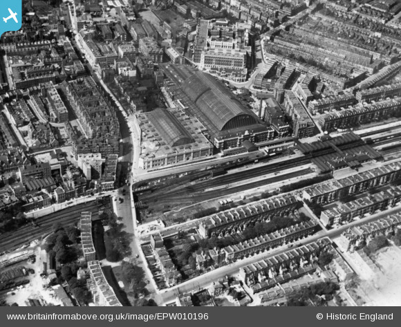
EPW010196 ENGLAND (1924). The Olympia Exhibition Hall, Olympia, 1924. This image has been produced from a print.
© Copyright OpenStreetMap contributors and licensed by the OpenStreetMap Foundation. 2024. Cartography is licensed as CC BY-SA.
Nearby Images (28)
EPW010196

EPW025092
 station and environs, West Kensington, 1928")
EAW022039
 Station, Olympia, 1949")
EAW022042
 Station, Olympia, 1949")
EPW025090
 station and environs, West Kensington, 1928")
EAW022038
 Station, Olympia, 1949")
EPW006523

EPW006522

EPW045413

EPW010195

EAW022040

EPW010194

EPR000403

EPR000404

EPR000447

EAW009112

EAW018714

EAW022043
 Station, Olympia, 1949")
EPW025089

EAW018713

EPW010179

EAW022041
 Station, Olympia, 1949")
EPR000448

EPW025093
 station and environs, West Kensington, 1928")
EPW024267

EAW004912

EPW025091

EPW059340

Details
| Title | [EPW010196] The Olympia Exhibition Hall, Olympia, 1924. This image has been produced from a print. |
| Reference | EPW010196 |
| Date | April-1924 |
| Link | |
| Place name | OLYMPIA |
| Parish | |
| District | |
| Country | ENGLAND |
| Easting / Northing | 524404, 179038 |
| Longitude / Latitude | -0.20767988594031, 51.496093229046 |
| National Grid Reference | TQ244790 |
Pins
Be the first to add a comment to this image!


