
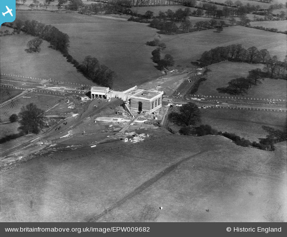
EPW009682 ENGLAND (1923). Burnt Oak Railway Station under construction, Burnt Oak, 1923
© Copyright OpenStreetMap contributors and licensed by the OpenStreetMap Foundation. 2024. Cartography is licensed as CC BY-SA.
Nearby Images (21)
EPW009682

EPW009344

EPW016517

EPW016519

EPW009346

EPW009363

EPW009345

EPW009347

EPW031549

EPW031548

EPW031583

EPW019336

EPW031550

EPW019190

EPW016518

EPW034858

EPW035548

EPW001350

EPW019191

EPW019338

EPW019337

Details
| Title | [EPW009682] Burnt Oak Railway Station under construction, Burnt Oak, 1923 |
| Reference | EPW009682 |
| Date | 1923 |
| Link | |
| Place name | BURNT OAK |
| Parish | |
| District | |
| Country | ENGLAND |
| Easting / Northing | 520333, 190702 |
| Longitude / Latitude | -0.26231178100628, 51.60181416642 |
| National Grid Reference | TQ203907 |
Pins
Be the first to add a comment to this image!
User Comment Contributions
 Like a number of tube stations, Burnt Oak (Watling) was set down in empty fields. It wasn't until 1926 when construction of the LCC Watling estate commenced that development of the district took off. This 1923 image shows the power or transformer house almost complete. The station remained little more than a shed at street level until the present station building was completed in 1929/30. |
 colsouth111 |
Thursday 30th of May 2013 10:25:50 AM |


