
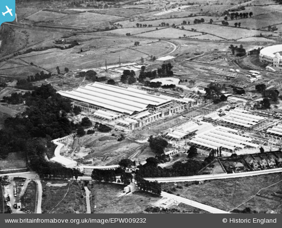
EPW009232 ENGLAND (1923). The British Empire Exhibition site under construction, Wembley Park, 1923. This image has been produced from a copy negative.
© Copyright OpenStreetMap contributors and licensed by the OpenStreetMap Foundation. 2024. Cartography is licensed as CC BY-SA.
Nearby Images (22)
EPW009232

EPW008721

EPW009540

EPW008242

EPW020861

EPW011385

EPW007825

EAW018316

EPW010736

EPW009601

EPW010842

EPW009654

EAW018314

EAW026797

EPW009807

EPW040769

EPW012752

EPW009806

EPW010726

EPW040768

EPW010847

EPW009602

Details
| Title | [EPW009232] The British Empire Exhibition site under construction, Wembley Park, 1923. This image has been produced from a copy negative. |
| Reference | EPW009232 |
| Date | 1923 |
| Link | |
| Place name | WEMBLEY PARK |
| Parish | |
| District | |
| Country | ENGLAND |
| Easting / Northing | 519447, 185961 |
| Longitude / Latitude | -0.2767129761495, 51.559389243128 |
| National Grid Reference | TQ194860 |
Pins
Be the first to add a comment to this image!


