
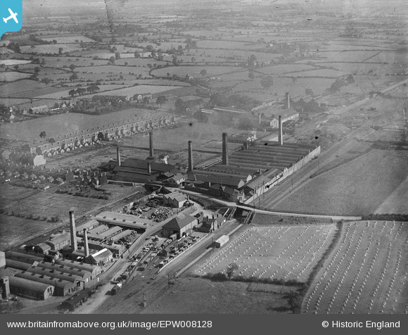
EPW008128 ENGLAND (1922). The Weldless Steel Tube Works and environs, Wednesfield, 1922
© Copyright OpenStreetMap contributors and licensed by the OpenStreetMap Foundation. 2024. Cartography is licensed as CC BY-SA.
Nearby Images (2)
EPW008128

EPW008129

Details
| Title | [EPW008128] The Weldless Steel Tube Works and environs, Wednesfield, 1922 |
| Reference | EPW008128 |
| Date | September-1922 |
| Link | |
| Place name | WEDNESFIELD |
| Parish | |
| District | |
| Country | ENGLAND |
| Easting / Northing | 394861, 299819 |
| Longitude / Latitude | -2.0758760035355, 52.595785644457 |
| National Grid Reference | SO949998 |
Pins
 WendyV |
Monday 13th of October 2014 08:13:13 AM | |
WendyV |
Monday 13th of October 2014 08:11:49 AM | |
WendyV |
Monday 13th of October 2014 08:10:32 AM | |
WendyV |
Monday 13th of October 2014 08:09:56 AM | |
WendyV |
Monday 13th of October 2014 07:59:49 AM | |
Martin |
Wednesday 20th of November 2013 11:29:37 AM | |
Martin |
Wednesday 20th of November 2013 11:26:25 AM | |
Martin |
Wednesday 20th of November 2013 11:25:44 AM | |
Martin |
Wednesday 20th of November 2013 11:24:19 AM | |
Closed to navigation 1961 and since filled in. |
John W |
Friday 10th of February 2017 06:45:53 PM |
Martin |
Wednesday 20th of November 2013 11:23:25 AM | |
Opened 1872, closed to passengers 1931, and completely in 1965. But the section to here from the west was reopened to serve the Tube works in 1970, and remained in use until 1983. See http://www.disused-stations.org.uk/w/wednesfield/index.shtml for information on the history of the station and line and photos of the station and associated buildings. |
John W |
Friday 10th of February 2017 06:44:52 PM |


