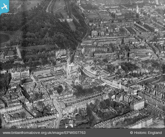
EPW007763 ENGLAND (1922). Kensington High Street and environs, Kensington, 1922
© Copyright OpenStreetMap contributors and licensed by the OpenStreetMap Foundation. 2024. Cartography is licensed as CC BY-SA.
Nearby Images (16)
EPW007763

EPW060790

EAW022729

EPW005730

EPW007761

EPW007764

EPW005724

EPW007762

EPW007758

EPW007759

EPW007760

EPW007756

EPW045416

EPW007757

EPW007755

EPW022563

Details
| Title | [EPW007763] Kensington High Street and environs, Kensington, 1922 |
| Reference | EPW007763 |
| Date | 13-May-1922 |
| Link | |
| Place name | KENSINGTON |
| Parish | |
| District | |
| Country | ENGLAND |
| Easting / Northing | 525802, 179703 |
| Longitude / Latitude | -0.18731215804282, 51.50176082282 |
| National Grid Reference | TQ258797 |
Pins
 Class31 |
Thursday 11th of September 2014 07:51:06 PM | |
 Alan McFaden |
Tuesday 17th of December 2013 10:23:23 PM | |
Alan McFaden |
Sunday 7th of July 2013 11:17:09 AM | |
Alan McFaden |
Sunday 7th of July 2013 11:15:59 AM | |
Alan McFaden |
Sunday 7th of July 2013 11:14:48 AM | |
Class31 |
Tuesday 22nd of January 2013 03:40:22 PM | |
Class31 |
Tuesday 22nd of January 2013 03:37:38 PM | |
Class31 |
Tuesday 22nd of January 2013 03:26:17 PM | |
Class31 |
Tuesday 22nd of January 2013 03:25:33 PM | |
Class31 |
Tuesday 22nd of January 2013 03:25:16 PM | |
Class31 |
Tuesday 22nd of January 2013 03:24:31 PM | |
Class31 |
Tuesday 22nd of January 2013 03:18:58 PM | |
Class31 |
Tuesday 22nd of January 2013 03:17:33 PM |