
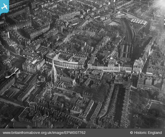
EPW007762 ENGLAND (1922). Kensington High Street and environs, Kensington, 1922
© Copyright OpenStreetMap contributors and licensed by the OpenStreetMap Foundation. 2024. Cartography is licensed as CC BY-SA.
Nearby Images (16)
EPW007762

EPW007759

EPW005724

EPW045416

EPW007756

EPW007761

EPW007758

EPW007764

EPW007755

EPW007760

EPW005730

EPW007757

EAW022729

EPW060790

EPW007763

EPW056404

Details
| Title | [EPW007762] Kensington High Street and environs, Kensington, 1922 |
| Reference | EPW007762 |
| Date | 13-May-1922 |
| Link | |
| Place name | KENSINGTON |
| Parish | |
| District | |
| Country | ENGLAND |
| Easting / Northing | 525617, 179631 |
| Longitude / Latitude | -0.19000204548653, 51.501154840266 |
| National Grid Reference | TQ256796 |
Pins
 OldAdam |
Tuesday 9th of August 2022 07:49:50 PM | |
OldAdam |
Tuesday 9th of August 2022 07:47:44 PM | |
 Class31 |
Tuesday 23rd of September 2014 08:42:48 PM | |
Class31 |
Thursday 11th of September 2014 06:19:16 PM | |
Class31 |
Tuesday 22nd of January 2013 03:40:38 PM | |
Class31 |
Tuesday 22nd of January 2013 03:37:24 PM | |
Class31 |
Tuesday 22nd of January 2013 03:27:55 PM | |
Class31 |
Tuesday 22nd of January 2013 03:24:10 PM | |
Class31 |
Tuesday 22nd of January 2013 03:19:13 PM | |
Class31 |
Tuesday 22nd of January 2013 03:17:16 PM |


User Comment Contributions
 Kensington Church Street, 23/09/2014 |
Class31 |
Tuesday 23rd of September 2014 08:43:59 PM |


