
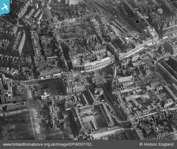
EPW007761 ENGLAND (1922). St Mary Abbott's Church and Kensington High Street and environs, Kensington, 1922
© Copyright OpenStreetMap contributors and licensed by the OpenStreetMap Foundation. 2024. Cartography is licensed as CC BY-SA.
Nearby Images (16)
EPW007761

EPW007764

EPW005730

EPW005724

EPW007762

EPW007759

EAW022729

EPW007763

EPW007758

EPW060790

EPW045416

EPW007756

EPW007760

EPW007755

EPW007757

EPW056404

Details
| Title | [EPW007761] St Mary Abbott's Church and Kensington High Street and environs, Kensington, 1922 |
| Reference | EPW007761 |
| Date | 13-May-1922 |
| Link | |
| Place name | KENSINGTON |
| Parish | |
| District | |
| Country | ENGLAND |
| Easting / Northing | 525689, 179668 |
| Longitude / Latitude | -0.18895197905156, 51.50147138729 |
| National Grid Reference | TQ257797 |
Pins
 The Laird |
Thursday 26th of June 2014 03:36:47 PM | |
 Class31 |
Tuesday 22nd of January 2013 03:40:55 PM | |
Class31 |
Tuesday 22nd of January 2013 03:37:08 PM | |
Class31 |
Tuesday 22nd of January 2013 03:28:18 PM | |
Class31 |
Tuesday 22nd of January 2013 03:23:52 PM | |
Class31 |
Tuesday 22nd of January 2013 03:19:29 PM | |
Class31 |
Tuesday 22nd of January 2013 03:16:55 PM |


