
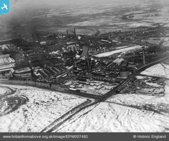
EPW007481 ENGLAND (1922). Chemical Works and the Victoria Iron Works, Ettingshall, 1922
© Copyright OpenStreetMap contributors and licensed by the OpenStreetMap Foundation. 2024. Cartography is licensed as CC BY-SA.
Nearby Images (4)
EPW007481

EPW007480

EPW007482

EAW017751
 Works on Bilston Road, Monmore Green, from the south, 1948. This image has been produced from a print.")
Details
| Title | [EPW007481] Chemical Works and the Victoria Iron Works, Ettingshall, 1922 |
| Reference | EPW007481 |
| Date | 10-February-1922 |
| Link | |
| Place name | ETTINGSHALL |
| Parish | |
| District | |
| Country | ENGLAND |
| Easting / Northing | 392640, 297361 |
| Longitude / Latitude | -2.1086137964173, 52.573660633517 |
| National Grid Reference | SO926974 |


