
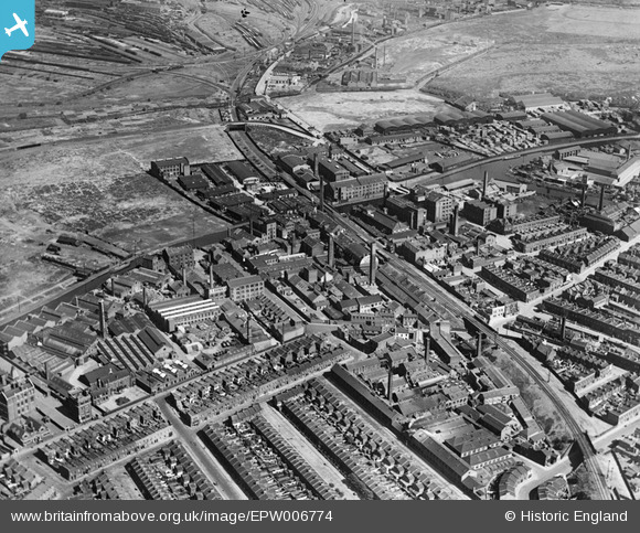
EPW006774 ENGLAND (1921). The Clarnico Works, Hackney Wick, 1921
© Copyright OpenStreetMap contributors and licensed by the OpenStreetMap Foundation. 2024. Cartography is licensed as CC BY-SA.
Nearby Images (11)
EPW006774

EPW006775

EPW006773

EPW006772

EPW006776

EPW006770

EPW006777

EPW011914

EPW011886

EPW006771

EPW009965

Details
| Title | [EPW006774] The Clarnico Works, Hackney Wick, 1921 |
| Reference | EPW006774 |
| Date | June-1921 |
| Link | |
| Place name | HACKNEY WICK |
| Parish | |
| District | |
| Country | ENGLAND |
| Easting / Northing | 537195, 184622 |
| Longitude / Latitude | -0.021334920705374, 51.543317431648 |
| National Grid Reference | TQ372846 |
Pins
 gBr |
Monday 6th of March 2017 09:35:28 PM | |
 8-2007.JPG) Keith |
Sunday 15th of February 2015 06:16:53 PM | |
Keith |
Sunday 15th of February 2015 06:15:51 PM | |
Keith |
Sunday 15th of February 2015 06:14:12 PM | |
Keith |
Sunday 15th of February 2015 06:13:10 PM | |
Keith |
Sunday 15th of February 2015 06:09:49 PM | |
Keith |
Sunday 15th of February 2015 06:07:34 PM | |
bookem1976 |
Wednesday 20th of March 2013 12:27:11 PM |


