
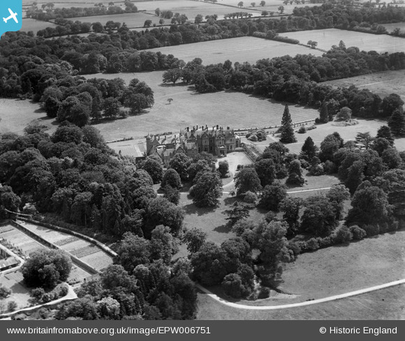
EPW006751 ENGLAND (1921). Rendlesham Hall, Rendlesham, 1921
© Copyright OpenStreetMap contributors and licensed by the OpenStreetMap Foundation. 2024. Cartography is licensed as CC BY-SA.
Nearby Images (3)
EPW006751

EPW006754

EPW006753

Details
| Title | [EPW006751] Rendlesham Hall, Rendlesham, 1921 |
| Reference | EPW006751 |
| Date | June-1921 |
| Link | |
| Place name | RENDLESHAM |
| Parish | RENDLESHAM |
| District | |
| Country | ENGLAND |
| Easting / Northing | 633726, 253933 |
| Longitude / Latitude | 1.4155895065066, 52.13376551087 |
| National Grid Reference | TM337539 |
Pins
Be the first to add a comment to this image!
User Comment Contributions
Soon after this pic was taken this house was sold and became used as a nursing home. Used by the army and Women's Land Army in WW2, but was left unoccupied after the war's end. Like so many country houses in the period, it was demolished in 1949 (source: The Lost Country Houses of Suffolk, by Bill Roberts, 2010). |
 Ex_Aerofilms_Librarian |
Monday 27th of August 2012 07:22:55 PM |


