
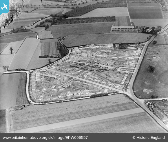
EPW006557 ENGLAND (1921). A new housing estate under construction at Marsh Green, Dagenham, 1921
© Copyright OpenStreetMap contributors and licensed by the OpenStreetMap Foundation. 2024. Cartography is licensed as CC BY-SA.
Nearby Images (13)
EPW006557

EPW005339

EPW006559

EPW005340

EPW005343

EPW006556

EPW005341

EPW005338

EPW006558

EPW005342

EPW035589

EAW026138

EAW026158

Details
| Title | [EPW006557] A new housing estate under construction at Marsh Green, Dagenham, 1921 |
| Reference | EPW006557 |
| Date | 7-June-1921 |
| Link | |
| Place name | DAGENHAM |
| Parish | |
| District | |
| Country | ENGLAND |
| Easting / Northing | 549277, 183701 |
| Longitude / Latitude | 0.1523975248614, 51.531974547291 |
| National Grid Reference | TQ493837 |
Pins
 JOHN_MAP |
Thursday 5th of July 2012 10:25:16 AM |


