
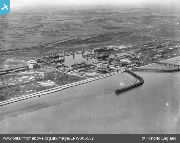
EPW006532 ENGLAND (1921). The Docks, Immingham Dock, 1921. This image has been produced from a copy-negative.
© Copyright OpenStreetMap contributors and licensed by the OpenStreetMap Foundation. 2024. Cartography is licensed as CC BY-SA.
Nearby Images (16)
EPW006532

EAW030243

EAW029085

EAW029082

EAW030250

EAW029079

EAW030242

EAW029088

EAW030252

EAW029081

EAW030249

EAW030247

EAW030241

EAW030251

EAW029089

EAW030244

Details
| Title | [EPW006532] The Docks, Immingham Dock, 1921. This image has been produced from a copy-negative. |
| Reference | EPW006532 |
| Date | June-1921 |
| Link | |
| Place name | IMMINGHAM DOCK |
| Parish | IMMINGHAM |
| District | |
| Country | ENGLAND |
| Easting / Northing | 519886, 416183 |
| Longitude / Latitude | -0.18691357020295, 53.628195299741 |
| National Grid Reference | TA199162 |
Pins
Be the first to add a comment to this image!


