
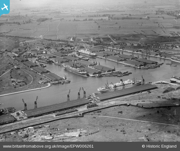
EPW006261 ENGLAND (1921). Tilbury Docks, Tilbury, 1921
© Copyright OpenStreetMap contributors and licensed by the OpenStreetMap Foundation. 2024. Cartography is licensed as CC BY-SA.
Nearby Images (26)
EPW006261

EPW044211

EPW018636

EAW028813

EPW001398

EPW032809

EPW032810

EAW028812

EAW028809

EAW028810

EPW017646

EPW044215

EAW028808

EPW032812

EPW032807

EPW044214

EPW044220

EPW032804

EPW032811

EPW018637

EPW044212

EPR000362

EPW044221

EPW001396

EAW002337

EAW042098

Details
| Title | [EPW006261] Tilbury Docks, Tilbury, 1921 |
| Reference | EPW006261 |
| Date | 23-May-1921 |
| Link | |
| Place name | TILBURY |
| Parish | |
| District | |
| Country | ENGLAND |
| Easting / Northing | 563483, 175674 |
| Longitude / Latitude | 0.35333442049053, 51.455917715981 |
| National Grid Reference | TQ635757 |
Pins
Be the first to add a comment to this image!


