
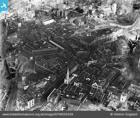
EPW005428 ENGLAND (1921). Rupert Street and environs, Bristol, 1921
© Copyright OpenStreetMap contributors and licensed by the OpenStreetMap Foundation. 2024. Cartography is licensed as CC BY-SA.
Nearby Images (17)
EPW005428

EPW005419

EPW022277

EPW005431

EPW060118

EPW005432

EPW005430

EPW005429

EPW005427

EPW005423

EPW005426

EPW033500

EPW005425

EPW005424

EPW005422

EPW005421

EPW005420

Details
| Title | [EPW005428] Rupert Street and environs, Bristol, 1921 |
| Reference | EPW005428 |
| Date | 20-March-1921 |
| Link | |
| Place name | BRISTOL |
| Parish | |
| District | |
| Country | ENGLAND |
| Easting / Northing | 358770, 173239 |
| Longitude / Latitude | -2.5934730628835, 51.456138658024 |
| National Grid Reference | ST588732 |
Pins
 Class31 |
Monday 8th of October 2012 01:19:24 PM | |
Class31 |
Monday 8th of October 2012 01:17:57 PM | |
Class31 |
Monday 8th of October 2012 01:16:03 PM | |
Class31 |
Monday 8th of October 2012 01:14:17 PM | |
Class31 |
Monday 8th of October 2012 01:13:45 PM | |
Class31 |
Monday 8th of October 2012 01:13:01 PM | |
Class31 |
Monday 8th of October 2012 01:12:39 PM | |
Class31 |
Monday 1st of October 2012 07:54:07 PM | |
Class31 |
Monday 1st of October 2012 07:53:37 PM | |
 Chelsea61 |
Sunday 29th of July 2012 11:01:03 AM | |
Chelsea61 |
Sunday 29th of July 2012 11:00:32 AM |


