
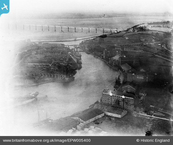
EPW005400 ENGLAND (1921). The Severn Rail Bridge and the Dock Basin, Sharpness, 1921
© Copyright OpenStreetMap contributors and licensed by the OpenStreetMap Foundation. 2024. Cartography is licensed as CC BY-SA.
Nearby Images (6)
EPW005400

EPW037752

EPW029346

EPW029343

EAW006849

EPW029347

Details
| Title | [EPW005400] The Severn Rail Bridge and the Dock Basin, Sharpness, 1921 |
| Reference | EPW005400 |
| Date | March-1921 |
| Link | |
| Place name | SHARPNESS |
| Parish | HINTON |
| District | |
| Country | ENGLAND |
| Easting / Northing | 367256, 202536 |
| Longitude / Latitude | -2.4740628633037, 51.720133784011 |
| National Grid Reference | SO673025 |
Pins
 gerry-r |
Sunday 22nd of June 2014 12:45:49 AM | |
 Class31 |
Tuesday 16th of October 2012 08:32:06 PM | |
Class31 |
Tuesday 16th of October 2012 08:31:41 PM | |
Class31 |
Tuesday 16th of October 2012 08:27:17 PM | |
Class31 |
Tuesday 16th of October 2012 08:23:44 PM | |
Class31 |
Tuesday 16th of October 2012 08:21:03 PM | |
Class31 |
Tuesday 16th of October 2012 08:13:42 PM | |
Class31 |
Tuesday 16th of October 2012 05:09:24 PM | |
MB |
Sunday 23rd of September 2012 12:15:37 PM |
User Comment Contributions
Could see the bridge from house I was born in, and I never heard it called anything but the Severn Bridge. No mention of high level, or even railway. That only came after the motorway opened in 1966. Though the 1960 disaster (in which five men lost their lives) saw the end of the bridge's useful life reconstruction was seriously considered and demolition did not take place til 1969/70. |
gerry-r |
Sunday 22nd of June 2014 12:58:09 AM |
 The rail bridge that was famously damaged in an accident on 25 October 1960 (and subsequently demolished) |
Richard Fairhurst |
Monday 9th of July 2012 11:51:04 AM |


