
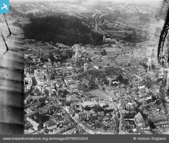
EPW001834 ENGLAND (1920). View over Ipswich Tower Street area, Ipswich, 1920
© Copyright OpenStreetMap contributors and licensed by the OpenStreetMap Foundation. 2024. Cartography is licensed as CC BY-SA.
Nearby Images (13)
EPW001834

EPW041399

EPW001824

EPW001835

EPW005298A

EPW005249

EPW005255

EPW032875

EPW058744

EAW024671

EPW001831

EPW005252

EPW005250

Details
| Title | [EPW001834] View over Ipswich Tower Street area, Ipswich, 1920 |
| Reference | EPW001834 |
| Date | June-1920 |
| Link | |
| Place name | IPSWICH |
| Parish | |
| District | |
| Country | ENGLAND |
| Easting / Northing | 616369, 244580 |
| Longitude / Latitude | 1.1564367870484, 52.056864047836 |
| National Grid Reference | TM164446 |


