
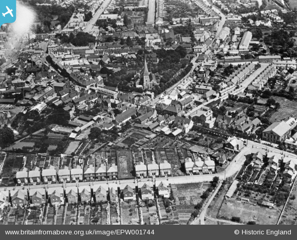
EPW001744 ENGLAND (1920). St Michael's Church and environs, Braintree, 1920. This image has been produced from a copy-negative.
© Copyright OpenStreetMap contributors and licensed by the OpenStreetMap Foundation. 2024. Cartography is licensed as CC BY-SA.
Nearby Images (5)
EPW001744

EAW043698

EPW001964

EAW043697

EAW001515

Details
| Title | [EPW001744] St Michael's Church and environs, Braintree, 1920. This image has been produced from a copy-negative. |
| Reference | EPW001744 |
| Date | June-1920 |
| Link | |
| Place name | BRAINTREE |
| Parish | |
| District | |
| Country | ENGLAND |
| Easting / Northing | 575505, 222923 |
| Longitude / Latitude | 0.5499485713672, 51.8767761908 |
| National Grid Reference | TL755229 |
Pins
 David Smith |
Monday 14th of February 2022 07:38:10 PM |


