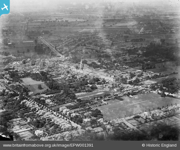
EPW001391 ENGLAND (1920). General view of the town centre, Romford, 1920
© Copyright OpenStreetMap contributors and licensed by the OpenStreetMap Foundation. 2024. Cartography is licensed as CC BY-SA.
Nearby Images (5)
EPW001391

EPW006268

EPW001394

EPW001390

EPW001405

Details
| Title | [EPW001391] General view of the town centre, Romford, 1920 |
| Reference | EPW001391 |
| Date | 7-June-1920 |
| Link | |
| Place name | ROMFORD |
| Parish | |
| District | |
| Country | ENGLAND |
| Easting / Northing | 551252, 188977 |
| Longitude / Latitude | 0.18312215305749, 51.578858431933 |
| National Grid Reference | TQ513890 |
Pins
 KB Productions |
Saturday 27th of June 2020 08:23:39 PM | |
 Billy Turner |
Tuesday 14th of July 2015 09:15:54 PM | |
 hillman34 |
Saturday 22nd of June 2013 05:47:53 PM | |
hillman34 |
Saturday 22nd of June 2013 05:35:43 PM | |
hillman34 |
Saturday 22nd of June 2013 05:33:15 PM | |
hillman34 |
Thursday 13th of June 2013 04:57:21 PM | |
 Class31 |
Tuesday 30th of October 2012 08:36:13 AM | |
Class31 |
Tuesday 30th of October 2012 08:35:21 AM |