
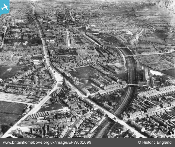
EPW001099 ENGLAND (1920). Carter's Green and environs, West Bromwich, 1920. This image has been produced from a print.
© Copyright OpenStreetMap contributors and licensed by the OpenStreetMap Foundation. 2024. Cartography is licensed as CC BY-SA.
Details
| Title | [EPW001099] Carter's Green and environs, West Bromwich, 1920. This image has been produced from a print. |
| Reference | EPW001099 |
| Date | May-1920 |
| Link | |
| Place name | WEST BROMWICH |
| Parish | |
| District | |
| Country | ENGLAND |
| Easting / Northing | 399787, 291690 |
| Longitude / Latitude | -2.0031396693289, 52.522722985469 |
| National Grid Reference | SO998917 |
Pins
 Emjay |
Thursday 27th of August 2020 01:33:43 PM | |
Warrick |
Tuesday 18th of August 2020 02:59:07 PM | |
Mikeya |
Wednesday 12th of June 2019 10:53:12 PM | |
Mikeya |
Wednesday 12th of June 2019 10:52:12 PM | |
Mikeya |
Wednesday 12th of June 2019 10:51:23 PM | |
Mikeya |
Wednesday 12th of June 2019 10:50:19 PM | |
Mikeya |
Wednesday 12th of June 2019 10:49:38 PM | |
Mikeya |
Wednesday 12th of June 2019 10:49:00 PM | |
Mikeya |
Wednesday 12th of June 2019 10:48:01 PM | |
Mikeya |
Wednesday 12th of June 2019 10:47:04 PM | |
Mikeya |
Wednesday 12th of June 2019 10:45:47 PM | |
Mikeya |
Wednesday 12th of June 2019 10:45:29 PM | |
Mike C |
Sunday 9th of August 2015 09:26:47 PM |


