
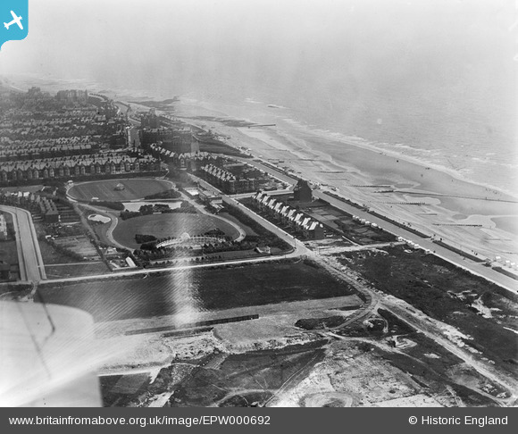
EPW000692 ENGLAND (1920). Egerton Park, Bexhill, from the west, 1920
© Copyright OpenStreetMap contributors and licensed by the OpenStreetMap Foundation. 2024. Cartography is licensed as CC BY-SA.
Nearby Images (4)
EPW000692

EPW035332

EPW026227
 Halt and surrounding residential area, Bexhill, 1929")
EPW026235

Details
| Title | [EPW000692] Egerton Park, Bexhill, from the west, 1920 |
| Reference | EPW000692 |
| Date | April-1920 |
| Link | |
| Place name | BEXHILL |
| Parish | |
| District | |
| Country | ENGLAND |
| Easting / Northing | 573307, 107095 |
| Longitude / Latitude | 0.46159683529926, 50.836838160947 |
| National Grid Reference | TQ733071 |
Pins
Be the first to add a comment to this image!
User Comment Contributions
Spot the cannon sited between the lawns on the promenade. Coastal defences were somewhat beefed up during the Second World War. |
 flakdodger |
Tuesday 26th of June 2012 09:53:24 AM |


