
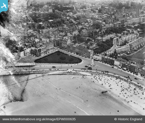
EPW000635 ENGLAND (1920). The Clock Tower, Margate, 1920
© Copyright OpenStreetMap contributors and licensed by the OpenStreetMap Foundation. 2024. Cartography is licensed as CC BY-SA.
Nearby Images (14)
EPW000635

EPW009238

EPW000630

EAW015843

EAW024856

EPW042848

EPW035473

EPW009162

EPW009161

EPW009164

EPW035469

EPW035465

EPW009241

EAW015842

Details
| Title | [EPW000635] The Clock Tower, Margate, 1920 |
| Reference | EPW000635 |
| Date | April-1920 |
| Link | |
| Place name | MARGATE |
| Parish | |
| District | |
| Country | ENGLAND |
| Easting / Northing | 635215, 170768 |
| Longitude / Latitude | 1.3810204121269, 51.386629691109 |
| National Grid Reference | TR352708 |
Pins
Be the first to add a comment to this image!


