
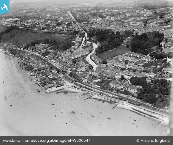
EPW000547 ENGLAND (1920). Leigh-on-Sea, Southend-on-Sea, from the south-east, 1920
© Copyright OpenStreetMap contributors and licensed by the OpenStreetMap Foundation. 2024. Cartography is licensed as CC BY-SA.
Nearby Images (18)
EPW000547

EPW036987

EPW037009

EPW032900

EPW036735

EAW024658

EAW041993

EPW036988

EPW000546

EAW041992

EPW036709

EPW036707

EPW058498

EPW040974

EPW036737

EPW037013

EAW041994

EPW058499

Details
| Title | [EPW000547] Leigh-on-Sea, Southend-on-Sea, from the south-east, 1920 |
| Reference | EPW000547 |
| Date | April-1920 |
| Link | |
| Place name | LEIGH-ON-SEA |
| Parish | LEIGH-ON-SEA |
| District | |
| Country | ENGLAND |
| Easting / Northing | 584049, 185647 |
| Longitude / Latitude | 0.65426187449826, 51.539191728881 |
| National Grid Reference | TQ840856 |
Pins
Be the first to add a comment to this image!


