
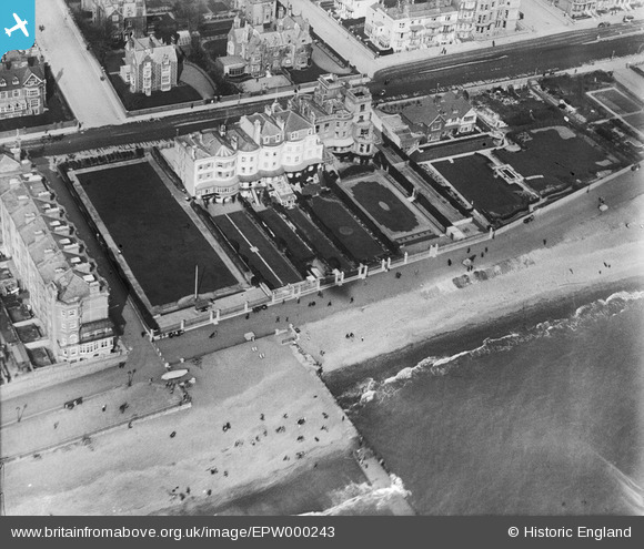
EPW000243 ENGLAND (1920). Courtenay Terrace, Hove, 1920
© Copyright OpenStreetMap contributors and licensed by the OpenStreetMap Foundation. 2024. Cartography is licensed as CC BY-SA.
Nearby Images (4)
EPW000243

EPW012371

EPW054043

EAW022687

Details
| Title | [EPW000243] Courtenay Terrace, Hove, 1920 |
| Reference | EPW000243 |
| Date | April-1920 |
| Link | |
| Place name | HOVE |
| Parish | |
| District | |
| Country | ENGLAND |
| Easting / Northing | 528687, 104340 |
| Longitude / Latitude | -0.172734572242, 50.82371981489 |
| National Grid Reference | TQ287043 |
Pins
 David Morley |
Monday 4th of November 2013 11:08:48 PM | |
classicforever |
Sunday 15th of July 2012 01:46:13 PM | |
classicforever |
Sunday 15th of July 2012 01:43:56 PM |
User Comment Contributions
 An architectural survivor on Hove seafront. |
classicforever |
Sunday 15th of July 2012 01:48:01 PM |


