
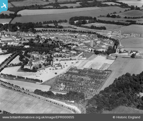
EPR000655 ENGLAND (1935). Netherne Hospital, Netherne on-the-Hill, 1935
© Copyright OpenStreetMap contributors and licensed by the OpenStreetMap Foundation. 2024. Cartography is licensed as CC BY-SA.
Nearby Images (5)
EPR000655

EPW036958

EPR000653

EAW011069

EPW036959

Details
| Title | [EPR000655] Netherne Hospital, Netherne on-the-Hill, 1935 |
| Reference | EPR000655 |
| Date | 23-June-1935 |
| Link | |
| Place name | NETHERNE ON-THE-HILL |
| Parish | |
| District | |
| Country | ENGLAND |
| Easting / Northing | 529440, 156232 |
| Longitude / Latitude | -0.14348309616698, 51.289983746403 |
| National Grid Reference | TQ294562 |
Pins
Be the first to add a comment to this image!


