
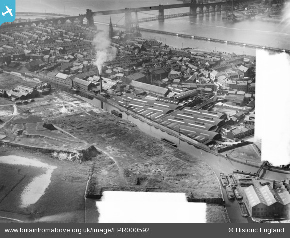
EPR000592 ENGLAND (1935). The Bridgewater Canal and Camden Tannery, Runcorn, 1935. This image was marked by Aero Pictorial Ltd for photo editing.
© Copyright OpenStreetMap contributors and licensed by the OpenStreetMap Foundation. 2024. Cartography is licensed as CC BY-SA.
Nearby Images (9)
EPR000592

EPR000591

EPW021651

EPR000593

EPR000590

EAW021990

EAW023485

EPW018919

EAW023481

Details
| Title | [EPR000592] The Bridgewater Canal and Camden Tannery, Runcorn, 1935. This image was marked by Aero Pictorial Ltd for photo editing. |
| Reference | EPR000592 |
| Date | 10-May-1935 |
| Link | |
| Place name | RUNCORN |
| Parish | |
| District | |
| Country | ENGLAND |
| Easting / Northing | 351400, 382871 |
| Longitude / Latitude | -2.7300072210099, 53.340236622983 |
| National Grid Reference | SJ514829 |
Pins
Be the first to add a comment to this image!


