
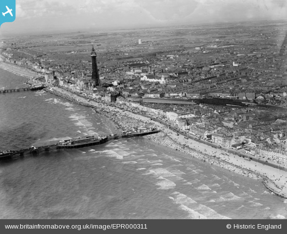
EPR000311 ENGLAND (1934). The Tower, the town and the seafront, Blackpool, from the south-west, 1934
© Copyright OpenStreetMap contributors and licensed by the OpenStreetMap Foundation. 2024. Cartography is licensed as CC BY-SA.
Nearby Images (7)
EPR000311

EPW038916

EPW002078

EPW002056

EPW002076

EAW026231

EAW026235

Details
| Title | [EPR000311] The Tower, the town and the seafront, Blackpool, from the south-west, 1934 |
| Reference | EPR000311 |
| Date | 30-August-1934 |
| Link | |
| Place name | BLACKPOOL |
| Parish | |
| District | |
| Country | ENGLAND |
| Easting / Northing | 330492, 435393 |
| Longitude / Latitude | -3.0557067770339, 53.809961852669 |
| National Grid Reference | SD305354 |
Pins
Be the first to add a comment to this image!


