
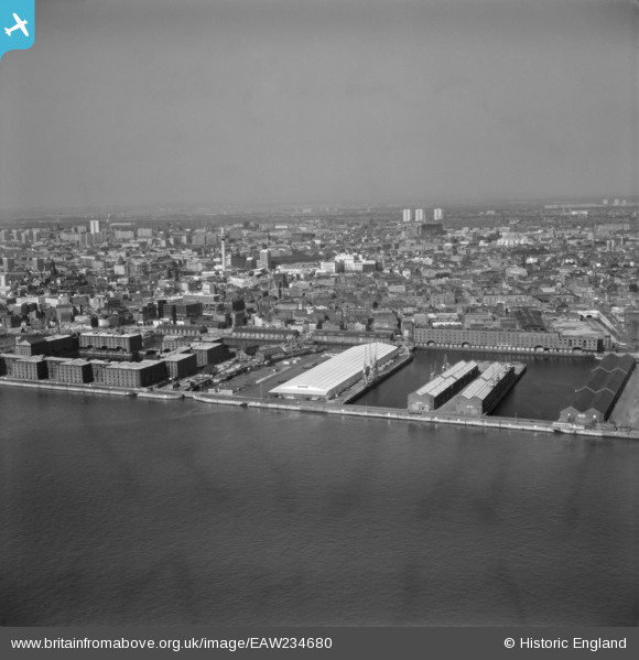
EAW234680 ENGLAND (1972). The Albert Dock and environs, from the south-west, 1972
© Copyright OpenStreetMap contributors and licensed by the OpenStreetMap Foundation. 2024. Cartography is licensed as CC BY-SA.
Nearby Images (2)
EAW234680

EPR000323

Details
| Title | [EAW234680] The Albert Dock and environs, from the south-west, 1972 |
| Reference | EAW234680 |
| Date | 17-July-1972 |
| Link | |
| Place name | LIVERPOOL |
| Parish | NON CIVIL PARISH |
| District | |
| Country | ENGLAND |
| Easting / Northing | 334123, 389448 |
| Longitude / Latitude | -2.9908542971192, 53.397483308837 |
| National Grid Reference | SJ341894 |
Pins
 austin |
Sunday 27th of November 2022 01:00:10 PM | |
austin |
Saturday 1st of October 2022 09:48:19 PM | |
austin |
Monday 24th of January 2022 10:47:37 PM | |
austin |
Monday 24th of January 2022 10:42:30 PM | |
austin |
Thursday 17th of September 2020 09:30:43 AM | |
austin |
Thursday 17th of September 2020 09:28:56 AM | |
austin |
Thursday 17th of September 2020 09:20:30 AM | |
austin |
Thursday 17th of September 2020 09:13:05 AM | |
austin |
Thursday 17th of September 2020 09:06:47 AM | |
austin |
Thursday 17th of September 2020 09:01:46 AM | |
rivermersey |
Sunday 2nd of August 2020 01:56:11 PM | |
rivermersey |
Sunday 2nd of August 2020 01:47:46 PM | |
Bob Fraser |
Wednesday 2nd of December 2015 02:07:09 AM |


