
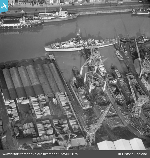
EAW061875 ENGLAND (1955). Albion Dockyard, Bristol, 1955
© Copyright OpenStreetMap contributors and licensed by the OpenStreetMap Foundation. 2024. Cartography is licensed as CC BY-SA.
Nearby Images (5)
EAW061875

EAW033315

EAW250863

EAW033316
 moored off Hotwell Road, Bristol, 1950")
EAW033321

Details
| Title | [EAW061875] Albion Dockyard, Bristol, 1955 |
| Reference | EAW061875 |
| Date | 10-November-1955 |
| Link | |
| Place name | BRISTOL |
| Parish | NON CIVIL PARISH |
| District | |
| Country | ENGLAND |
| Easting / Northing | 357713, 172332 |
| Longitude / Latitude | -2.6085783749515, 51.447904857606 |
| National Grid Reference | ST577723 |
Pins
 MB |
Wednesday 31st of August 2016 10:03:53 AM | |
MB |
Wednesday 31st of August 2016 10:02:49 AM | |
MB |
Wednesday 31st of August 2016 10:01:57 AM | |
Allan |
Monday 16th of November 2015 10:52:14 PM |


