
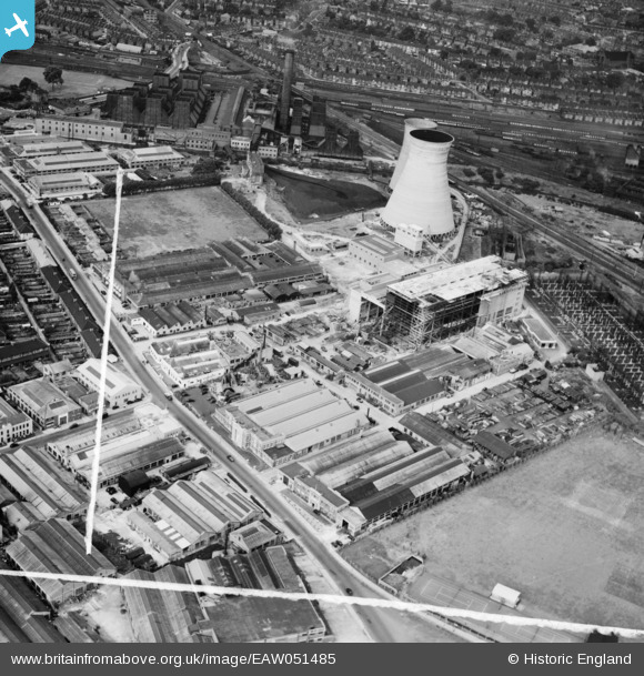
EAW051485 ENGLAND (1953). Industrial premises along Chase Road, North Acton, 1953. This image was marked by Aerofilms Ltd for photo editing.
© Copyright OpenStreetMap contributors and licensed by the OpenStreetMap Foundation. 2024. Cartography is licensed as CC BY-SA.
Nearby Images (31)
EAW051485

EAW051481

EAW051489

EAW051490

EAW051487

EAW051486

EAW051483

EAW052495

EAW051484

EAW051482

EAW051488

EAW052502

EAW052499

EAW052497

EAW052503

EAW052494

EAW052496

EAW052498

EAW052501

EPW034975

EAW052500

EPW034976

EAW009109

EAW000469

EAW009099

EAW009105

EAW009106

EPW054156

EAW033529

EAW033531

EPW054158

Details
| Title | [EAW051485] Industrial premises along Chase Road, North Acton, 1953. This image was marked by Aerofilms Ltd for photo editing. |
| Reference | EAW051485 |
| Date | 12-August-1953 |
| Link | |
| Place name | NORTH ACTON |
| Parish | |
| District | |
| Country | ENGLAND |
| Easting / Northing | 520910, 182745 |
| Longitude / Latitude | -0.25672170854088, 51.53017119302 |
| National Grid Reference | TQ209827 |
Pins
 Matt Aldred edob.mattaldred.com |
Friday 15th of March 2024 08:36:05 PM |


