
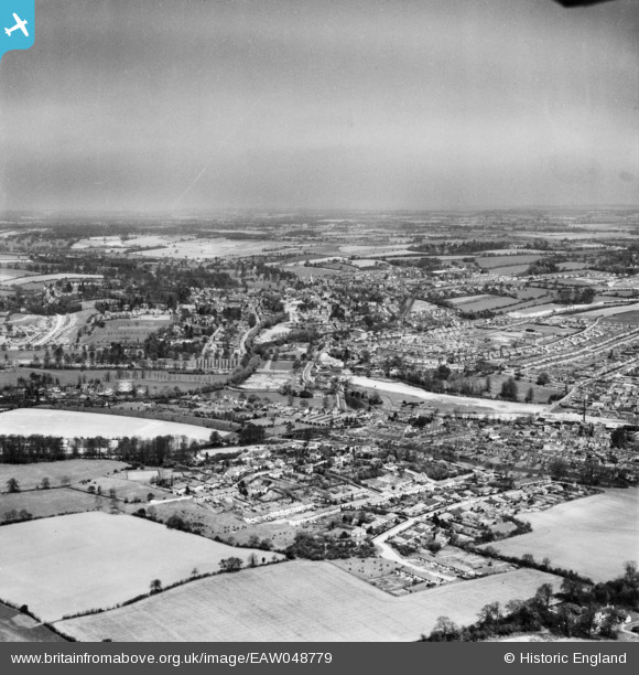
EAW048779 ENGLAND (1953). The town, Hemel Hempstead, from the south, 1953
© Copyright OpenStreetMap contributors and licensed by the OpenStreetMap Foundation. 2024. Cartography is licensed as CC BY-SA.
Nearby Images (2)
EAW048779

EAW048780

Details
| Title | [EAW048779] The town, Hemel Hempstead, from the south, 1953 |
| Reference | EAW048779 |
| Date | 22-April-1953 |
| Link | |
| Place name | HEMEL HEMPSTEAD |
| Parish | |
| District | |
| Country | ENGLAND |
| Easting / Northing | 505462, 205169 |
| Longitude / Latitude | -0.47260302383918, 51.73484068228 |
| National Grid Reference | TL055052 |
Pins
 OldBill |
Monday 8th of June 2020 08:12:51 PM | |
H.E. |
Tuesday 27th of February 2018 03:25:35 PM | |
H.E. |
Sunday 28th of January 2018 11:18:52 PM | |
H.E. |
Sunday 28th of January 2018 11:17:25 PM | |
H.E. |
Sunday 28th of January 2018 11:15:05 PM | |
H.E. |
Sunday 28th of January 2018 11:13:04 PM | |
H.E. |
Sunday 28th of January 2018 11:10:46 PM | |
H.E. |
Sunday 28th of January 2018 11:08:39 PM | |
H.E. |
Wednesday 14th of January 2015 08:26:44 PM | |
H.E. |
Wednesday 14th of January 2015 08:23:11 PM | |
H.E. |
Wednesday 14th of January 2015 08:21:53 PM | |
H.E. |
Wednesday 14th of January 2015 08:19:10 PM | |
H.E. |
Wednesday 14th of January 2015 08:16:50 PM | |
H.E. |
Wednesday 14th of January 2015 08:15:24 PM | |
H.E. |
Wednesday 14th of January 2015 08:14:10 PM | |
H.E. |
Wednesday 14th of January 2015 08:12:51 PM | |
H.E. |
Wednesday 14th of January 2015 08:06:26 PM | |
H.E. |
Wednesday 14th of January 2015 08:04:31 PM | |
H.E. |
Wednesday 14th of January 2015 08:02:41 PM | |
H.E. |
Wednesday 14th of January 2015 06:45:53 PM | |
H.E. |
Wednesday 14th of January 2015 06:36:46 PM | |
Vulpine |
Tuesday 11th of November 2014 05:44:48 PM | |
Vulpine |
Tuesday 11th of November 2014 05:43:58 PM | |
Vulpine |
Tuesday 11th of November 2014 05:43:13 PM | |
Walksleader |
Tuesday 7th of October 2014 06:43:53 PM |


