
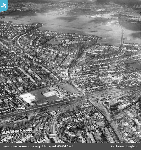
EAW047577 ENGLAND (1952). Purley Railway Station and environs, Purley, 1952
© Copyright OpenStreetMap contributors and licensed by the OpenStreetMap Foundation. 2024. Cartography is licensed as CC BY-SA.
Nearby Images (3)
EAW047577

EAW047578

EAW047576

Details
| Title | [EAW047577] Purley Railway Station and environs, Purley, 1952 |
| Reference | EAW047577 |
| Date | 23-October-1952 |
| Link | |
| Place name | PURLEY |
| Parish | |
| District | |
| Country | ENGLAND |
| Easting / Northing | 531223, 161745 |
| Longitude / Latitude | -0.11589560420013, 51.339126080311 |
| National Grid Reference | TQ312617 |
Pins
 Mike |
Tuesday 25th of July 2023 07:05:53 PM | |
Mike |
Tuesday 25th of July 2023 07:05:20 PM | |
Mike |
Tuesday 25th of July 2023 07:02:57 PM | |
Mike |
Tuesday 25th of July 2023 06:58:49 PM | |
Mike |
Tuesday 25th of July 2023 06:55:58 PM | |
 Matt Aldred edob.mattaldred.com |
Tuesday 5th of May 2020 09:33:02 PM | |
williamayerst |
Monday 11th of November 2019 08:46:40 PM | |
Nowy Paul |
Saturday 23rd of March 2019 01:23:25 PM |


