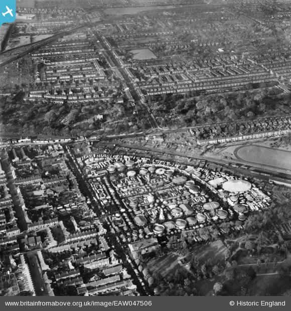
EAW047506 ENGLAND (1952). Kingston upon Hull, Hull Fair at the Fair Ground on Walton Street, 1952
© Copyright OpenStreetMap contributors and licensed by the OpenStreetMap Foundation. 2024. Cartography is licensed as CC BY-SA.
Nearby Images (5)
EAW047506

EAW047509

EAW047507

EAW047508

EAW047510

Details
| Title | [EAW047506] Kingston upon Hull, Hull Fair at the Fair Ground on Walton Street, 1952 |
| Reference | EAW047506 |
| Date | 10-October-1952 |
| Link | |
| Place name | KINGSTON UPON HULL |
| Parish | |
| District | |
| Country | ENGLAND |
| Easting / Northing | 507340, 429425 |
| Longitude / Latitude | -0.37197845839811, 53.749904922122 |
| National Grid Reference | TA073294 |
Pins
 Martin_J |
Monday 2nd of December 2019 12:23:48 AM | |
Martin_J |
Monday 2nd of December 2019 12:22:46 AM | |
John Wass |
Tuesday 2nd of September 2014 03:53:00 PM | |
John Wass |
Saturday 30th of August 2014 08:16:42 PM | |
nfh249 |
Thursday 24th of July 2014 12:26:26 PM |