
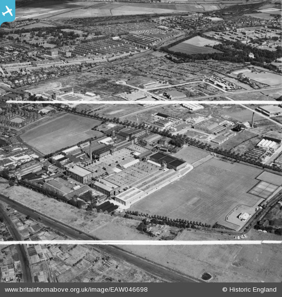
EAW046698 ENGLAND (1952). The Jacob's Bakery Ltd Biscuit Factory on Long Lane and environs, Liverpool, 1952. This image was marked by Aerofilms Ltd for photo editing.
© Copyright OpenStreetMap contributors and licensed by the OpenStreetMap Foundation. 2024. Cartography is licensed as CC BY-SA.
Nearby Images (22)
EAW046698

EAW046696

EPR000616

EAW046701

EPW042684

EAW004624

EAW046697

EAW046695

EAW046705

EPW042685

EPW018935

EPW042682

EAW046702

EAW046694

EAW046699

EAW046700

EPW042683

EAW046704

EAW046706

EAW046703

EAW005650

EAW004622

Details
| Title | [EAW046698] The Jacob's Bakery Ltd Biscuit Factory on Long Lane and environs, Liverpool, 1952. This image was marked by Aerofilms Ltd for photo editing. |
| Reference | EAW046698 |
| Date | 7-September-1952 |
| Link | |
| Place name | LIVERPOOL |
| Parish | |
| District | |
| Country | ENGLAND |
| Easting / Northing | 337070, 396158 |
| Longitude / Latitude | -2.9478761819379, 53.458154633283 |
| National Grid Reference | SJ371962 |
Pins
 austin |
Friday 18th of September 2020 11:04:38 AM |


