
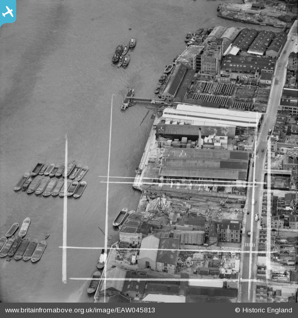
EAW045813 ENGLAND (1952). Wharfage on the River Thames behind West Ferry Road, Millwall, 1952. This image was marked by Aerofilms Ltd for photo editing.
© Copyright OpenStreetMap contributors and licensed by the OpenStreetMap Foundation. 2024. Cartography is licensed as CC BY-SA.
Nearby Images (17)
EAW045813

EAW045811

EAW045809

EAW045812

EAW045676

EAW016654

EAW045808

EAW045807

EAW045680

EAW045810

EAW045677

EAW045679

EAW075653

EAW045675

EAW045673

EAW045678

EAW045674

Details
| Title | [EAW045813] Wharfage on the River Thames behind West Ferry Road, Millwall, 1952. This image was marked by Aerofilms Ltd for photo editing. |
| Reference | EAW045813 |
| Date | 31-July-1952 |
| Link | |
| Place name | MILLWALL |
| Parish | |
| District | |
| Country | ENGLAND |
| Easting / Northing | 537017, 179839 |
| Longitude / Latitude | -0.025760742818398, 51.500375261301 |
| National Grid Reference | TQ370798 |
Pins
Be the first to add a comment to this image!


