
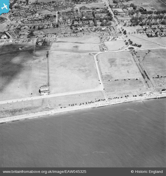
EAW045325 ENGLAND (1952). Western Esplanade and the residential area around Cleveland Road and Furtherwick Road, Canvey Island, 1952
© Copyright OpenStreetMap contributors and licensed by the OpenStreetMap Foundation. 2024. Cartography is licensed as CC BY-SA.
Nearby Images (14)
EAW045325

EAW051014

EAW051054

EAW045324

EAW051053

EAW051055

EAW051015

EAW045326

EAW051056

EAW045336

EAW026916

EAW051013

EAW051052

EAW026917

Details
| Title | [EAW045325] Western Esplanade and the residential area around Cleveland Road and Furtherwick Road, Canvey Island, 1952 |
| Reference | EAW045325 |
| Date | 2-August-1952 |
| Link | |
| Place name | CANVEY ISLAND |
| Parish | CANVEY ISLAND |
| District | |
| Country | ENGLAND |
| Easting / Northing | 579970, 182433 |
| Longitude / Latitude | 0.59386012720175, 51.511634982018 |
| National Grid Reference | TQ800824 |
Pins
Be the first to add a comment to this image!


