
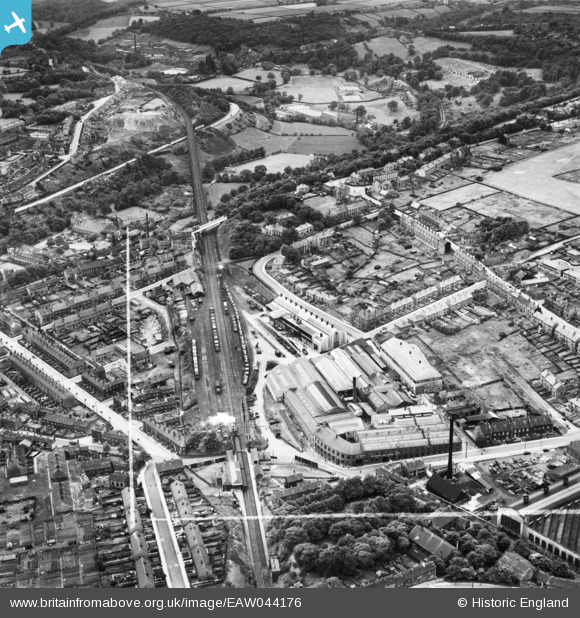
EAW044176 ENGLAND (1952). The William Whiteley and Sons Works alongside the J. Charlesworth Foundry and environs, Lockwood, 1952. This image was marked by Aerofilms Ltd for photo editing.
© Copyright OpenStreetMap contributors and licensed by the OpenStreetMap Foundation. 2024. Cartography is licensed as CC BY-SA.
Nearby Images (20)
EAW044176

EAW006200

EAW044170

EPW054262

EAW044177

EAW044172

EAW044175

EAW006201

EAW006198

EAW006199

EAW006205

EAW044173

EAW006206

EAW006202

EAW006203

EAW044174

EAW044171

EAW006207

EAW006208

EAW006204

Details
| Title | [EAW044176] The William Whiteley and Sons Works alongside the J. Charlesworth Foundry and environs, Lockwood, 1952. This image was marked by Aerofilms Ltd for photo editing. |
| Reference | EAW044176 |
| Date | 19-June-1952 |
| Link | |
| Place name | LOCKWOOD |
| Parish | |
| District | |
| Country | ENGLAND |
| Easting / Northing | 413214, 415115 |
| Longitude / Latitude | -1.8001501385269, 53.632159406931 |
| National Grid Reference | SE132151 |
Pins
 Ann |
Thursday 22nd of June 2017 12:40:10 AM |


