
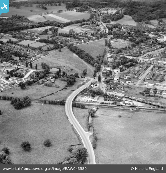
EAW043589 ENGLAND (1952). Abridge Road, Theydon Bois, 1952
© Copyright OpenStreetMap contributors and licensed by the OpenStreetMap Foundation. 2024. Cartography is licensed as CC BY-SA.
Nearby Images (4)
EAW043589

EAW037030

EAW037029

EAW037031

Details
| Title | [EAW043589] Abridge Road, Theydon Bois, 1952 |
| Reference | EAW043589 |
| Date | 4-June-1952 |
| Link | |
| Place name | THEYDON BOIS |
| Parish | THEYDON BOIS |
| District | |
| Country | ENGLAND |
| Easting / Northing | 545370, 199033 |
| Longitude / Latitude | 0.10246026867103, 51.670772280825 |
| National Grid Reference | TQ454990 |


