
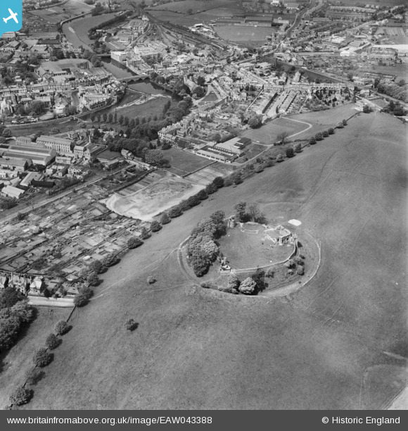
EAW043388 ENGLAND (1952). Kendal Castle, Kendal, 1952
© Copyright OpenStreetMap contributors and licensed by the OpenStreetMap Foundation. 2024. Cartography is licensed as CC BY-SA.
Nearby Images (13)
EAW043388

EAW043389

EAW043386

EPW026811

EPW038831

EPW026542

EAW043387

EPW026548

EPW026747

EPW026753

EPW026751

EPW026755

EPW026756

Details
| Title | [EAW043388] Kendal Castle, Kendal, 1952 |
| Reference | EAW043388 |
| Date | 13-May-1952 |
| Link | |
| Place name | KENDAL |
| Parish | KENDAL |
| District | |
| Country | ENGLAND |
| Easting / Northing | 352132, 492547 |
| Longitude / Latitude | -2.7360986868945, 54.326097105159 |
| National Grid Reference | SD521925 |
Pins
Be the first to add a comment to this image!


