
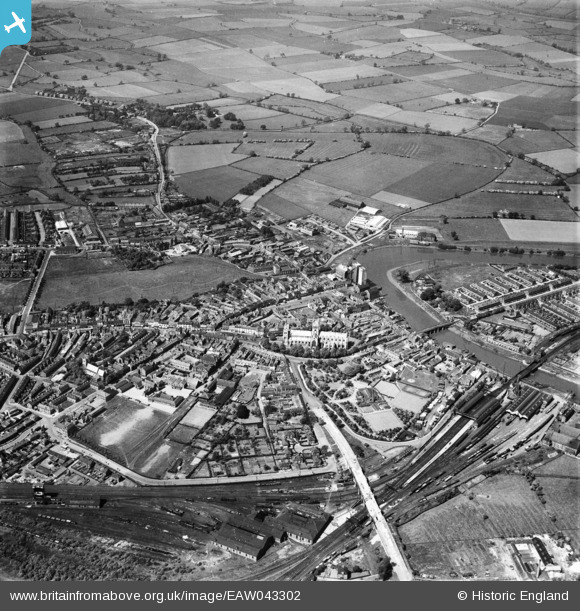
EAW043302 ENGLAND (1952). The town, Selby, 1952
© Copyright OpenStreetMap contributors and licensed by the OpenStreetMap Foundation. 2024. Cartography is licensed as CC BY-SA.
Nearby Images (14)
EAW043302

EAW043301

EPW015450

EPW015451

EPW040263

EPW015455

EAW015504

EPW015453

EPW015454

EPW040264

EPW015452

EAW015735

EPW015448

EAW015505

Details
| Title | [EAW043302] The town, Selby, 1952 |
| Reference | EAW043302 |
| Date | 23-May-1952 |
| Link | |
| Place name | SELBY |
| Parish | SELBY |
| District | |
| Country | ENGLAND |
| Easting / Northing | 461499, 432536 |
| Longitude / Latitude | -1.0664876535675, 53.785292520344 |
| National Grid Reference | SE615325 |
Pins
 redmist |
Wednesday 13th of May 2020 10:59:12 PM | |
nick |
Thursday 13th of February 2020 08:15:24 AM | |
nick |
Thursday 13th of February 2020 08:14:30 AM | |
nick |
Thursday 13th of February 2020 08:13:47 AM | |
gBr |
Friday 3rd of March 2017 12:29:47 PM | |
gBr |
Friday 3rd of March 2017 12:28:21 PM | |
jon |
Wednesday 1st of March 2017 07:12:06 PM | |
Lydia |
Thursday 16th of February 2017 01:34:33 PM |


