
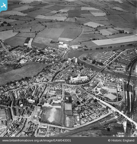
EAW043301 ENGLAND (1952). Selby Abey and the town centre, Selby, 1952
© Copyright OpenStreetMap contributors and licensed by the OpenStreetMap Foundation. 2024. Cartography is licensed as CC BY-SA.
Nearby Images (14)
EAW043301

EAW043302

EPW015450

EPW015451

EPW040263

EPW015455

EPW015453

EAW015504

EPW015454

EPW015452

EPW040264

EAW015505

EPW015448

EAW015735

Details
| Title | [EAW043301] Selby Abey and the town centre, Selby, 1952 |
| Reference | EAW043301 |
| Date | 23-May-1952 |
| Link | |
| Place name | SELBY |
| Parish | SELBY |
| District | |
| Country | ENGLAND |
| Easting / Northing | 461531, 432530 |
| Longitude / Latitude | -1.0660031844804, 53.785234811295 |
| National Grid Reference | SE615325 |
Pins
 ernie |
Friday 8th of January 2021 08:29:07 PM | |
MB |
Sunday 25th of September 2016 11:32:13 AM | |
MB |
Sunday 25th of September 2016 11:30:20 AM | |
MB |
Sunday 25th of September 2016 11:28:50 AM | |
MB |
Sunday 25th of September 2016 11:27:02 AM |


